
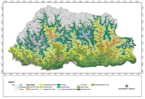
 Almost around 71% percent of the geographical land of Bhutan is covered with different forest types. In order to understand the spatial distribution of different forest types, the Department of Forests and Park Services has developed the Forest Type Map, which is first of its kind in Bhutan. The Forest Type Map is based on the forest type classification carried out by A.J.C Grierson and D.G. Long in 1983. The details of the classification can be found in the Flora of Bhutan Volume I, Part I. Forest Type Map was developed using the National Forest Inventory data and Landsat 8. Through this map, one can now see where different forest types area located in Bhutan.
To download, click the link:
Forest Types Map of Bhutan, 2022 (3356 downloads ) ![]()
